
1969 Map of Tuttle
USGS Topo · Published 1972About this map
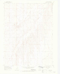
Tuttle sits at the northern edge of this high plains landscape, overlooking the complex drainage system where the South Fork Republican River and Republican River converge. The topography is defined by the sharp incisions of Spring Creek and Dry Gulch into the surrounding plateau, creating a network of draws and ridges that contrast with the flat upland stretches. This 1969 field-checked survey illustrates a sparsely populated agricultural region in Kit Carson County, where land use is oriented toward the watercourses. Scattered Well sites across the terrain indicate the critical importance of groundwater for sustaining the area's homesteads and operations far from the primary riverbanks.
Find a feature on this map
6 named features on this map. Tap any name to fly to it.
Don’t see what you’re looking for? This feature index may not catch every label — zoom into the map to look around manually.
Map Details
Editions of this 1969 Tuttle Map
4 editions found
Other maps of this area

1954 · Limon
USGS Topo · 1:250,000

1957 · Limon
USGS Topo · 1:250,000

1958 · Limon
USGS Topo · 1:250,000

1969 · Settlement
USGS Topo · 1:24,000

1969 · Bethune
USGS Topo · 1:24,000

1969 · Idalia SW
USGS Topo · 1:24,000

1969 · Kirk
USGS Topo · 1:24,000

1969 · Stratton
USGS Topo · 1:24,000
1978 · Joes SW
USGS Topo · 1:24,000

1979 · Vona
USGS Topo · 1:24,000