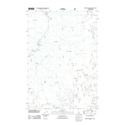
2011 Map of Kirkwood Creek
USGS Topo · Published 2011About this map
Upper Pittsburg Landing and the adjacent Pittsburg Landing serve as critical points of access to the Snake River in this section of the Snake River Canyon. The landscape is defined by its ranching and grazing history, evidenced by numerous historical sites such as Crooks Corral, Dixon Corrals, and Kirkwood Corrals. Settlement patterns follow the rugged topography, with family-named operations like the Davis Ranch, Calvin Ranch, and Henry Baker Ranch established near essential water sources like China Creek and Kirkwood Creek.
Find a feature on this map
62 named features on this map. Tap any name to fly to it.
Don’t see what you’re looking for? This feature index may not catch every label — zoom into the map to look around manually.
Map Details
Editions of this 2011 Kirkwood Creek Map
This is the sole edition of this map. No revisions or reprints were ever made.
Other maps of this area

1922 · He Devil
USGS Topo · 1:48,000

1938 · Riggins
USGS Topo · 1:96,000

1945 · Riggins
USGS Topo · 1:125,000

1954 · Kernan Point
USGS Topo · 1:62,500

1955 · Grangeville
USGS Topo · 1:250,000

1957 · He Devil
USGS Topo · 1:62,500

1959 · Grangeville
USGS Topo · 1:250,000

1963 · Lucile
USGS Topo · 1:24,000

1963 · Slate Creek
USGS Topo · 1:24,000

1963 · Kirkwood Creek
USGS Topo · 1:24,000