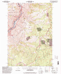
1995 Map of Kirkwood Creek
USGS Topo · Published 1999About this map
Hells Canyon defines the western edge of this 1990s-era landscape, where the Snake River carves through the Idaho-Oregon border. This river corridor is a primary focal point, marked by a succession of challenging water features including China Rapids, Muir Rapids, and Durham Rapids. The map reveals a land utilized for both recreation and historic ranching, evidenced by the Kirkwood Historic Ranch and several high-altitude outposts such as Dixon Cow Camp and Cold Springs Cow Camp. Industrial and archaeological history is visible in the presence of Pictographs along the river and the Blue Jacket Mine and Hardin Mill further inland. The rugged verticality of the terrain is bridged by landmarks like Wick iup Butte and Triangle Mountain, while the Nez Perce National Forest and Wallowa-Whitman National Forest manage the surrounding wilderness areas, reflecting the remote and preserved character of this river-driven economy.
Find a feature on this map
67 named features on this map. Tap any name to fly to it.
Don’t see what you’re looking for? This feature index may not catch every label — zoom into the map to look around manually.
Map Details
Editions of this 1995 Kirkwood Creek Map
This is the sole edition of this map. No revisions or reprints were ever made.
Other maps of this area

1922 · He Devil
USGS Topo · 1:48,000

1938 · Riggins
USGS Topo · 1:96,000

1945 · Riggins
USGS Topo · 1:125,000

1954 · Kernan Point
USGS Topo · 1:62,500

1955 · Grangeville
USGS Topo · 1:250,000

1957 · He Devil
USGS Topo · 1:62,500

1959 · Grangeville
USGS Topo · 1:250,000

1963 · Lucile
USGS Topo · 1:24,000

1963 · Slate Creek
USGS Topo · 1:24,000

1963 · Kirkwood Creek
USGS Topo · 1:24,000