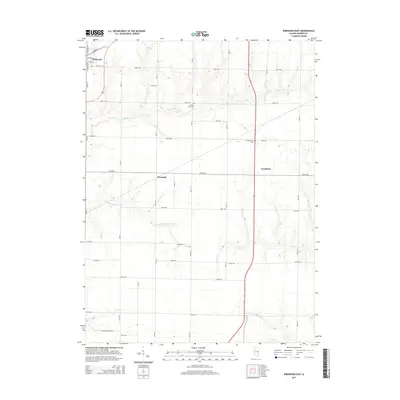
2015 Map of Kirkwood East
USGS Topo · Published 2015About this map
Kirkwood anchors the northwestern corner of this Warren County landscape, where the structured residential grid of North St and E Walnut St meets the expansive rural road network. This region of Illinois is defined by its agricultural layout, with a sequence of east-west avenues spanning from 160th Ave down to 84th Ave. Smaller settlements like Ponemah and Larchland are situated along these transit corridors, reflecting the enduring pattern of prairie hamlets that once served as vital local hubs.
Find a feature on this map
26 named features on this map. Tap any name to fly to it.
Don’t see what you’re looking for? This feature index may not catch every label — zoom into the map to look around manually.
Map Details
Editions of this 2015 Kirkwood East Map
This is the sole edition of this map. No revisions or reprints were ever made.
Other maps of this area

1916 · Good Hope
USGS Topo · 1:62,500

1918 · La Harpe
USGS Topo · 1:62,500

1918 · Good Hope
USGS Topo · 1:62,500

1921 · Monmouth
USGS Topo · 1:62,500

1923 · Monmouth
USGS Topo · 1:62,500

1934 · Oquawka
USGS Topo · 1:48,000

1940 · Oquawka
USGS Topo · 1:62,500

1958 · Burlington
USGS Topo · 1:250,000

1961 · Burlington
USGS Topo · 1:250,000

1963 · Burlington
USGS Topo · 1:250,000