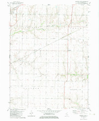
1982 Map of Kirkwood East
USGS Topo · Published 1983About this map
Kirkwood sits in the northwestern corner of this agricultural region, serving as a primary rail and settlement hub at the intersection of the Burlington Northern line and local road networks. The landscape is defined by the headwaters and branches of several prominent waterways, including Henderson Creek and its South Fork, as well as Cedar Creek to the south. These drainage systems carve subtle relief into the prairie, where small rural communities like Ponemah and Larchland are situated along the Atchison Topeka and Santa Fe railroad.
Find a feature on this map
16 named features on this map. Tap any name to fly to it.
Don’t see what you’re looking for? This feature index may not catch every label — zoom into the map to look around manually.
Map Details
Editions of this 1982 Kirkwood East Map
This is the sole edition of this map. No revisions or reprints were ever made.
Other maps of this area

1916 · Good Hope
USGS Topo · 1:62,500

1918 · La Harpe
USGS Topo · 1:62,500

1918 · Good Hope
USGS Topo · 1:62,500

1921 · Monmouth
USGS Topo · 1:62,500

1923 · Monmouth
USGS Topo · 1:62,500

1934 · Oquawka
USGS Topo · 1:48,000

1940 · Oquawka
USGS Topo · 1:62,500

1958 · Burlington
USGS Topo · 1:250,000

1961 · Burlington
USGS Topo · 1:250,000

1963 · Burlington
USGS Topo · 1:250,000