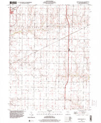
1998 Map of Kirkwood East
USGS Topo · Published 2000About this map
Kirkwood sits at the northwestern corner of this West-Central Illinois landscape, marking a transition from the structured township grids to the winding riparian corridors of South Fork Henderson Creek. The area is defined by its agrarian character and the historical boundaries of Tompkins, Lenox, Ellison, and Roseville. Smaller settlements such as Ponemah and Larchland are preserved here at the end of the twentieth century, alongside the quiet Hickory Point Cem located near the headwaters of the South Fork. This terrain is deeply incised by multiple drainage systems, including the southern flow of Cedar Creek and Negro Creek, which cut through the level prairie. These watercourses historically dictated the placement of homesteads and early transport routes, creating a distinct pattern of land use that remained visible during this 1998 survey.
Find a feature on this map
13 named features on this map. Tap any name to fly to it.
Don’t see what you’re looking for? This feature index may not catch every label — zoom into the map to look around manually.
Map Details
Editions of this 1998 Kirkwood East Map
This is the sole edition of this map. No revisions or reprints were ever made.
Other maps of this area

1916 · Good Hope
USGS Topo · 1:62,500

1918 · La Harpe
USGS Topo · 1:62,500

1918 · Good Hope
USGS Topo · 1:62,500

1921 · Monmouth
USGS Topo · 1:62,500

1923 · Monmouth
USGS Topo · 1:62,500

1934 · Oquawka
USGS Topo · 1:48,000

1940 · Oquawka
USGS Topo · 1:62,500

1958 · Burlington
USGS Topo · 1:250,000

1961 · Burlington
USGS Topo · 1:250,000

1963 · Burlington
USGS Topo · 1:250,000