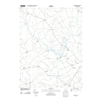
2010 Map of Kirkwood
USGS Topo · Published 2010About this map
Octoraro Lake and its surrounding wetlands form the central geographic feature of this landscape, where the West Branch Octoraro Creek and East Branch Octoraro Creek converge. The area is defined by numerous small crossroad settlements and hamlets such as Kirkwood, Little Britain, and Spruce Grove, connected by a dense network of local roads like Noble Rd and Street Rd. Evidence of the region’s agricultural and milling history is found in place names such as Puseyville, Kirks Mills, and Andrews Bridge. Significant local landmarks include Camp Tweedale on the eastern shore of the lake and the Pine Grove Dam. The map also details local genealogy and community sites, including Calvary Cemetery and Nottingham Cemetery, alongside several smaller communities like Elim, Oak Hill, and Summerhill that dot the southern Lancaster County terrain.
Find a feature on this map
116 named features on this map. Tap any name to fly to it.
Don’t see what you’re looking for? This feature index may not catch every label — zoom into the map to look around manually.
Map Details
Editions of this 2010 Kirkwood Map
This is the sole edition of this map. No revisions or reprints were ever made.
Other maps of this area

1898 · Elkton
USGS Topo · 1:62,500

1900 · Elkton
USGS Topo · 1:62,500

1900 · Havre De Grace
USGS Topo · 1:62,500

1904 · Coatesville
USGS Topo · 1:62,500

1906 · Coatesville
USGS Topo · 1:62,500

1912 · Quarryville
USGS Topo · 1:62,500

1917 · Elkton
USGS Topo · 1:62,500

1918 · Coatesville
USGS Topo · 1:62,500

1942 · Havre De Grace
USGS Topo · 1:62,500

1942 · Elkton
USGS Topo · 1:62,500
Featured Places
- Little Britain Township, PA
- Upper Oxford Township, PA
- East Drumore Township, PA
- Sadsbury Township, PA
- Eastland, Little Britain Township