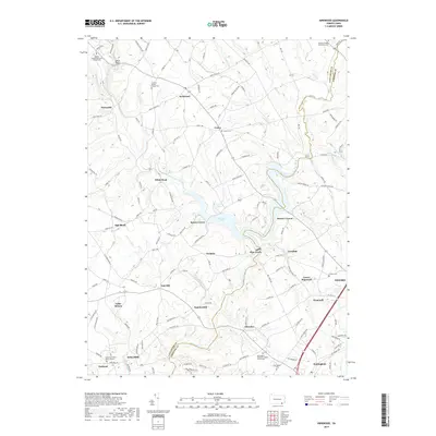
2019 Map of Kirkwood
USGS Topo · Published 2019About this map
Octoraro Lake serves as a central geographic anchor where the West Branch Octoraro Creek and East Branch Octoraro Creek converge near the boundary of Lancaster and Chester counties. This agricultural landscape is defined by a dense network of small settlements and religious landmarks, including the Wesley United Methodist Church Cem and the Eastland Friends Burial Ground. The layout of the region reflects its deep roots in various denominations, with the Andrews Bridge Mennonite Cem and Colerain Baptist Church Cem serving local communities. Small crossroads like Kirkwood and Puseyville connect rural homesteads via named routes such as Morrison Mill Rd and Pumping Station Rd, while larger hubs like Oxford and Nottingham appear along the southeastern edge. Many place names, such as Kirks Mills and Oak Shade, suggest the milling and timbering origins of these interior Pennsylvania townships.
Find a feature on this map
124 named features on this map. Tap any name to fly to it.
Don’t see what you’re looking for? This feature index may not catch every label — zoom into the map to look around manually.
Map Details
Editions of this 2019 Kirkwood Map
This is the sole edition of this map. No revisions or reprints were ever made.
Other maps of this area

1898 · Elkton
USGS Topo · 1:62,500

1900 · Elkton
USGS Topo · 1:62,500

1900 · Havre De Grace
USGS Topo · 1:62,500

1904 · Coatesville
USGS Topo · 1:62,500

1906 · Coatesville
USGS Topo · 1:62,500

1912 · Quarryville
USGS Topo · 1:62,500

1917 · Elkton
USGS Topo · 1:62,500

1918 · Coatesville
USGS Topo · 1:62,500

1942 · Havre De Grace
USGS Topo · 1:62,500

1942 · Elkton
USGS Topo · 1:62,500
Featured Places
- Little Britain Township, PA
- Upper Oxford Township, PA
- East Drumore Township, PA
- Sadsbury Township, PA
- Eastland, Little Britain Township