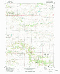
1982 Map of Kirkwood West
USGS Topo · Published 1983About this map
Burlington Northern tracks and the Atchison Topeka And Santa Fe railway define the transit corridors of western Illinois in this early 1980s survey. These parallel rail lines serve the agricultural communities of Biggsville, Smithshire, and Media, which are linked by a network of rural roads traversing the drainages of South Henderson Creek and Ellison Creek. The landscape is a mix of productive farmland and wooded creek bottoms, punctuated by several historic burial grounds including Biggsville Cem, Salters Grove Cem, and Walnut Grove Cem.
Find a feature on this map
27 named features on this map. Tap any name to fly to it.
Don’t see what you’re looking for? This feature index may not catch every label — zoom into the map to look around manually.
Map Details
Editions of this 1982 Kirkwood West Map
This is the sole edition of this map. No revisions or reprints were ever made.
Other maps of this area

1916 · Good Hope
USGS Topo · 1:62,500

1918 · La Harpe
USGS Topo · 1:62,500

1918 · Good Hope
USGS Topo · 1:62,500

1921 · Monmouth
USGS Topo · 1:62,500

1923 · Monmouth
USGS Topo · 1:62,500

1934 · Oquawka
USGS Topo · 1:48,000

1940 · Oquawka
USGS Topo · 1:62,500

1958 · Burlington
USGS Topo · 1:250,000

1961 · Burlington
USGS Topo · 1:250,000

1963 · Burlington
USGS Topo · 1:250,000