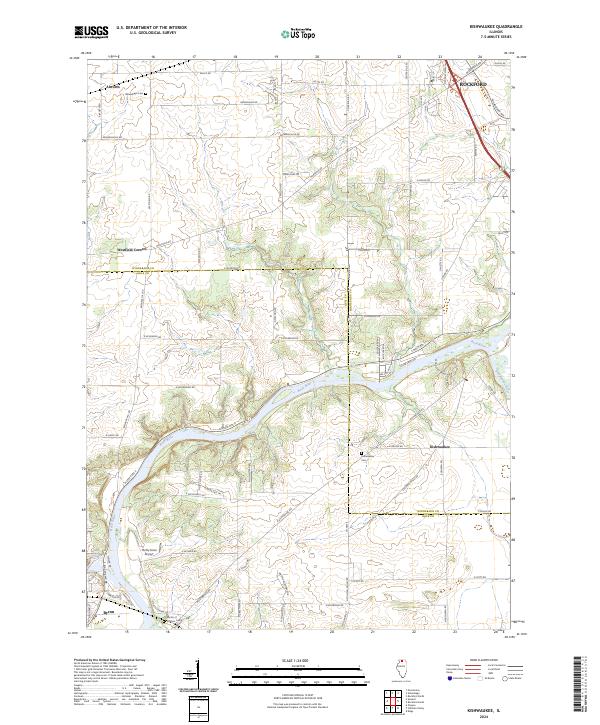
2024 Map of Kishwaukee
USGS Topo · Published 2024About this map
The confluence of the Rock River and the Kishwaukee River anchors this study of northern Illinois, where the landscape is defined by the winding river valleys and the agricultural plateaus between them. Small historic settlements such as Kishwaukee and Westfield Corners are connected by a network of rural roads like Montague Rd and Edwardsville Rd, showing a transition from the dense urban edge of Rockford in the northeast to the quieter valley floors near Byron.
Find a feature on this map
41 named features on this map. Tap any name to fly to it.
Don’t see what you’re looking for? This feature index may not catch every label — zoom into the map to look around manually.
Map Details
Editions of this 2024 Kishwaukee Map
This is the sole edition of this map. No revisions or reprints were ever made.
Other maps of this area

1917 · Kings
USGS Topo · 1:62,500

1918 · Rockford
USGS Topo · 1:62,500

1918 · Kings
USGS Topo · 1:62,500

1922 · Oregon
USGS Topo · 1:62,500

1924 · Oregon
USGS Topo · 1:62,500

1932 · Pecatonica
USGS Topo · 1:62,500

1936 · Pecatonica
USGS Topo · 1:62,500

1938 · Rockford
USGS Topo · 1:62,500

1949 · Camp Grant
USGS Topo · 1:24,000

1949 · Rockford
USGS Topo · 1:24,000