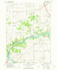
1971 Map of Kishwaukee
USGS Topo · Published 1973About this map
The confluence of the Rock River and the Kishwaukee River anchors this Illinois landscape along the boundary of Winnebago and Ogle Counties. In the early 1970s, this area was a mix of agriculture and institutional land use, featuring the Camp Medill McCormick and the Bishops Lane Retreat House. Small settlements like Alworth and Kishwaukee are documented alongside community hubs such as Evergreen School and Centerville School.
Find a feature on this map
59 named features on this map. Tap any name to fly to it.
Don’t see what you’re looking for? This feature index may not catch every label — zoom into the map to look around manually.
Map Details
Editions of this 1971 Kishwaukee Map
This is the sole edition of this map. No revisions or reprints were ever made.
Other maps of this area

1917 · Kings
USGS Topo · 1:62,500

1918 · Rockford
USGS Topo · 1:62,500

1918 · Kings
USGS Topo · 1:62,500

1922 · Oregon
USGS Topo · 1:62,500

1924 · Oregon
USGS Topo · 1:62,500

1932 · Pecatonica
USGS Topo · 1:62,500

1936 · Pecatonica
USGS Topo · 1:62,500

1938 · Rockford
USGS Topo · 1:62,500

1949 · Camp Grant
USGS Topo · 1:24,000

1949 · Rockford
USGS Topo · 1:24,000