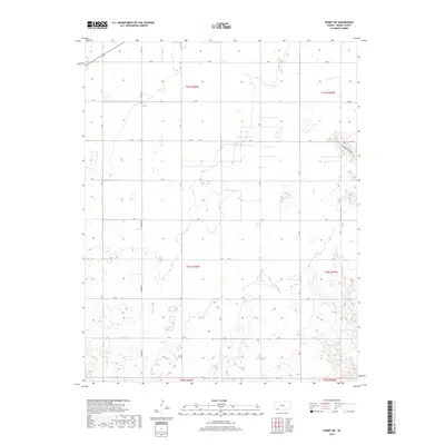
2018 Map of Kismet NE
USGS Topo · Published 2018About this map
The High Plains of Meade County are defined by an orderly grid of section lines and gravel paths, where drainage follows subtle depressions across the landscape. The most prominent natural incisions into this agricultural plateau are the winding courses of Stumpie Arroyo and Shorts Creek, which carve gentle meanders through the southern and eastern quadrants. The mapping reveals a highly structured rural environment, where the Public Land Survey System divides the territory into townships such as t33s r30w and t32s r29w, marked by alphabetical arteries ranging from Q Road in the north to Y Road at the southern boundary. This 2018 survey by the U.S. Geological Survey shows a sparsely populated area characterized by large-scale farming and livestock operations, with occasional industrial structures or grain facilities punctuating the fields along the western corridors near Ontario Street.
Find a feature on this map
17 named features on this map. Tap any name to fly to it.
Don’t see what you’re looking for? This feature index may not catch every label — zoom into the map to look around manually.
Map Details
Editions of this 2018 Kismet NE Map
This is the sole edition of this map. No revisions or reprints were ever made.
Other maps of this area

1892 · Meade
USGS Topo · 1:125,000

1955 · Dodge City
USGS Topo · 1:250,000

1958 · Dodge City
USGS Topo · 1:250,000

1959 · Dodge City
USGS Topo · 1:250,000

1963 · Plains
USGS Topo · 1:24,000

1963 · Kismet SE
USGS Topo · 1:24,000

1963 · Kismet NE
USGS Topo · 1:24,000

1963 · Lake Larrabee
USGS Topo · 1:24,000

1963 · Irish Flats
USGS Topo · 1:24,000

1963 · Missler
USGS Topo · 1:24,000