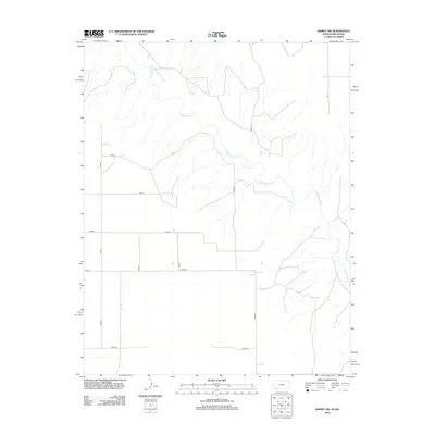
2012 Map of Kismet SW
USGS Topo · Published 2012About this map
The Cimarron River winds through the northern and eastern portions of this High Plains landscape, creating a distinct topographical corridor against the grid of the surrounding agricultural land. In the southwestern quadrant, the Biller Cem stands as a significant point of interest for genealogists and local historians, situated near the intersection of Road 0 and Road U. The map reveals a highly structured rural network defined by an alphanumeric system of county roads, including Road S and Co Road V, which facilitate movement across the Kansas and Oklahoma borderlands. This 2012 survey by the U.S. Geological Survey illustrates the modern configuration of Seward County's farm-to-market infrastructure and the drainage patterns feeding into the Cimarron valley.
Find a feature on this map
14 named features on this map. Tap any name to fly to it.
Don’t see what you’re looking for? This feature index may not catch every label — zoom into the map to look around manually.
Map Details
Editions of this 2012 Kismet SW Map
This is the sole edition of this map. No revisions or reprints were ever made.
Other maps of this area

1954 · Perryton
USGS Topo · 1:250,000

1955 · Dodge City
USGS Topo · 1:250,000

1958 · Perryton
USGS Topo · 1:250,000

1958 · Dodge City
USGS Topo · 1:250,000

1959 · Dodge City
USGS Topo · 1:250,000

1963 · Kismet SE
USGS Topo · 1:24,000

1963 · Kismet NE
USGS Topo · 1:24,000

1968 · Liberal NE
USGS Topo · 1:24,000
1971 · Kismet
USGS Topo · 1:24,000

1971 · Kismet SW
USGS Topo · 1:24,000