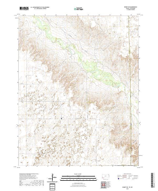
2022 Map of Kismet SW
USGS Topo · Published 2022About this map
The Cimarron River winds through this section of the High Plains, carving a distinct valley across the northern half of the landscape. This 2022 survey illustrates the grid-based rural infrastructure typical of the region, where a network of section-line roads like White Rd and Co Rd 4 facilitates access to remote agricultural parcels. Along the southern boundary, the Bixler Cem stands as a focal point for genealogical interest, providing a fixed reference for local family histories. The terrain shifts significantly in the southeast, where Wolf Canyon marks a departure from the relatively level plateau found elsewhere. The political geography is defined by the Seward Co Meade Co line, which bisects the eastern portion of the sheet, while named routes like Co River Rd follow the natural topography of the river basin.
Find a feature on this map
26 named features on this map. Tap any name to fly to it.
Don’t see what you’re looking for? This feature index may not catch every label — zoom into the map to look around manually.
Map Details
Editions of this 2022 Kismet SW Map
This is the sole edition of this map. No revisions or reprints were ever made.
Other maps of this area

1954 · Perryton
USGS Topo · 1:250,000

1955 · Dodge City
USGS Topo · 1:250,000

1958 · Perryton
USGS Topo · 1:250,000

1958 · Dodge City
USGS Topo · 1:250,000

1959 · Dodge City
USGS Topo · 1:250,000

1963 · Kismet SE
USGS Topo · 1:24,000

1963 · Kismet NE
USGS Topo · 1:24,000

1968 · Liberal NE
USGS Topo · 1:24,000
1971 · Kismet
USGS Topo · 1:24,000

1971 · Kismet SW
USGS Topo · 1:24,000