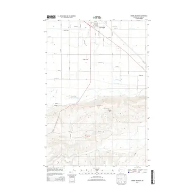
2014 Map of Kisumxi Mountain
USGS Topo · Published 2014About this map
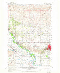
Toppenish sits at the northern edge of this study, where the developed streets of the town meet the agricultural irrigation networks of the Yakima Valley. The landscape is defined by the sharp transition from the flat, water-managed lowlands of the north to the rising elevation of Toppenish Ridge and Hembre Mtn in the south. This contrast highlights the region's complex water management system, featuring the Toppenish Drain, Marion Drain, and Parton Drain, which divert and manage flow alongside natural waterways like Wanity Slough. Below the ridge, the terrain remains largely undeveloped, carved by the winding paths of Satus Cr and Toppenish Cr. A dense network of rural roads, including Becker Rd, Meyers Rd, and Larue Rd, provides a detailed look at the property divisions and access points that supported the valley's rural economy in the early 21st century.
Find a feature on this map
53 named features on this map. Tap any name to fly to it.
Don’t see what you’re looking for? This feature index may not catch every label — zoom into the map to look around manually.
Map Details
Editions of this 2014 Kisumxi Mountain Map
This is the sole edition of this map. No revisions or reprints were ever made.
Other maps of this area

1910 · Zillah
USGS Topo · 1:125,000

1950 · Yakima
USGS Topo · 1:250,000

1958 · Hembre Mtn
USGS Topo · 1:24,000

1958 · Toppenish SW
USGS Topo · 1:24,000
1958 · Toppenish
USGS Topo · 1:24,000
1958 · Wapato
USGS Topo · 1:24,000

1958 · Yakima
USGS Topo · 1:250,000

1961 · Yakima
USGS Topo · 1:250,000
1965 · Bluelight NW
USGS Topo · 1:24,000
1965 · Granger
USGS Topo · 1:62,500