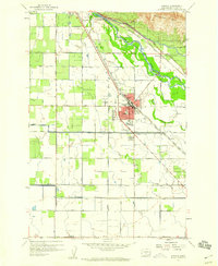
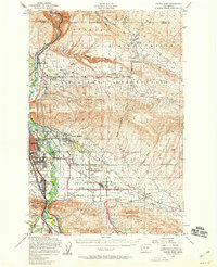
1958 Map of Wapato
USGS Topo · Published 1960About this map
The Yakima River defines the landscape of this 1950s irrigation-driven corridor, marking the Indian Reservation Boundary and feeding a complex network of waterways including the Wapato Canal and Sunnyside Canal. The settlement of Wapato serves as the central hub, characterized by its grid of schools and infrastructure, including Wapato High School and the KOC Radio Tower. To the north, the river is managed via the Sunnyside Dam and a nearby Gaging Station.
Find a feature on this map
35 named features on this map. Tap any name to fly to it.
Don’t see what you’re looking for? This feature index may not catch every label — zoom into the map to look around manually.
Map Details
Editions of this 1958 Wapato Map
4 editions found
Other maps of this area

1899 · Ellensburg
USGS Topo · 1:125,000

1901 · Ellensburg
USGS Topo · 1:125,000

1910 · Zillah
USGS Topo · 1:125,000

1936 · Yakima East
USGS Topo · 1:48,000

1937 · White Swan
USGS Topo · 1:125,000

1941 · Yakima East
USGS Topo · 1:62,500

1950 · Yakima
USGS Topo · 1:250,000

1953 · Elephant Mountain
USGS Topo · 1:24,000

1953 · Yakima East
USGS Topo · 1:24,000
1953 · Yakima East
USGS Topo · 1:62,500