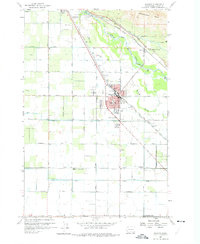
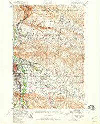
1958 Map of Wapato
USGS Topo · Published 1975About this map
The Yakima River winds through this Central Washington landscape, defining a complex irrigation and transport corridor between the Rattlesnake Hills and the fertile Yakima Valley floor. The town of Wapato serves as a central hub, densely plotted with its High School, water tanks, and sewage disposal systems, while the Northern Pacific railroad tracks parallel the Sunnyside Canal and the river's path. The map illustrates the region's agricultural infrastructure in the late 1950s, showing a grid of family-named roads like Kays Road and Higgins Road serving rural outposts. Smaller settlements and rail sidings such as Donald, Ashue, and Yethonat appear alongside civic landmarks like the Parker Heights Grange and the McKinley School, reflecting a well-established rural community organized around the water diverted at Sunnyside Dam.
Find a feature on this map
40 named features on this map. Tap any name to fly to it.
Don’t see what you’re looking for? This feature index may not catch every label — zoom into the map to look around manually.
Map Details
Editions of this 1958 Wapato Map
4 editions found
Other maps of this area

1899 · Ellensburg
USGS Topo · 1:125,000

1901 · Ellensburg
USGS Topo · 1:125,000

1910 · Zillah
USGS Topo · 1:125,000

1936 · Yakima East
USGS Topo · 1:48,000

1937 · White Swan
USGS Topo · 1:125,000

1941 · Yakima East
USGS Topo · 1:62,500

1950 · Yakima
USGS Topo · 1:250,000

1953 · Elephant Mountain
USGS Topo · 1:24,000

1953 · Yakima East
USGS Topo · 1:24,000
1953 · Yakima East
USGS Topo · 1:62,500