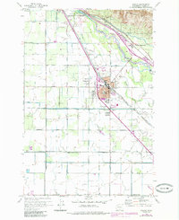
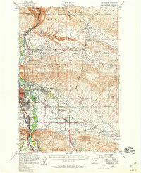
1958 Map of Wapato
USGS Topo · Published 1985About this map
The Yakima River defines the northeast corner of this territory, where the Sunnyside Canal and Wanity Slough weave through a landscape heavily engineered for agriculture. Centered on the town of Wapato, the map illustrates a complex grid of irrigation laterals and named rural roads such as Ashue Road and Progressive Road. This mid-century survey captures the community just before significant late-20th-century expansion, shown in purple revisions that extend the urban reach of Wapato.
Find a feature on this map
37 named features on this map. Tap any name to fly to it.
Don’t see what you’re looking for? This feature index may not catch every label — zoom into the map to look around manually.
Map Details
Editions of this 1958 Wapato Map
4 editions found
Other maps of this area

1899 · Ellensburg
USGS Topo · 1:125,000

1901 · Ellensburg
USGS Topo · 1:125,000

1910 · Zillah
USGS Topo · 1:125,000

1936 · Yakima East
USGS Topo · 1:48,000

1937 · White Swan
USGS Topo · 1:125,000

1941 · Yakima East
USGS Topo · 1:62,500

1950 · Yakima
USGS Topo · 1:250,000

1953 · Elephant Mountain
USGS Topo · 1:24,000

1953 · Yakima East
USGS Topo · 1:24,000
1953 · Yakima East
USGS Topo · 1:62,500