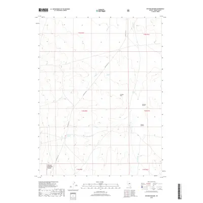
2018 Map of Kitchen Meadow
USGS Topo · Published 2018About this map
Klobe Hot Springs and the drainage of Hot Spring Wash characterize this arid landscape in central Nevada. The area is defined by the broad expanse of Antelope Valley, where high-elevation grazing lands like Antelope Meadow and Kitchen Meadow provided critical seasonal forage. The southwestern corner of the map reaches into the Toiyabe National Forest, marking a transition toward more protected public lands. Reliability of water is a clear theme, with several named sources including Warm Spring, Bradford Spring, and Antelope Spring appearing alongside seasonal courses like Dagget Cr and Cedar Cr. The primary thoroughfare through this remote terrain is Antelope Valley Rd, which connects these vital water points across the basin.
Find a feature on this map
20 named features on this map. Tap any name to fly to it.
Don’t see what you’re looking for? This feature index may not catch every label — zoom into the map to look around manually.
Map Details
Editions of this 2018 Kitchen Meadow Map
This is the sole edition of this map. No revisions or reprints were ever made.
Other maps of this area

1926 · Roberts Mountains
USGS Topo · 1:250,000

1929 · Roberts Mountains
USGS Topo · 1:250,000

1955 · Millett
USGS Topo · 1:250,000

1956 · Bellevue Peak
USGS Topo · 1:62,500

1956 · Bartine Ranch
USGS Topo · 1:62,500

1956 · Antelope Peak
USGS Topo · 1:62,500

1956 · Whistler Mtn
USGS Topo · 1:62,500

1959 · Millett
USGS Topo · 1:250,000

1978 · Summit Mountain
USGS Topo · 1:100,000

1979 · Simpson Park Mtns
USGS Topo · 1:100,000