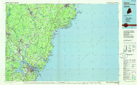
1985 Map of Kittery
USGS Topo · Published 1986About this map
The Piscataqua River forms the critical maritime boundary between Maine and New Hampshire in this mid-1980s coastal survey. The industrial and military significance of the harbor is anchored by the Portsmouth Naval Shipyard on Seavey Island, while the massive footprint of Pease Air Force Base dominates the landscape just west of the river. To the north and east, the transition from the busy urban corridors of Dover and Rochester into the smaller village centers of York and Kennebunk reveals the region’s dual identity as both a defense hub and a colonial-era residential landscape. Natural features such as Mount Agamenticus and the protected marshes of the Rachel Carson National Wildlife Refuge contrast with the heavy infrastructure of the Maine Turnpike and the Boston and Maine RR, showing how modern transport networks were overlaid upon centuries of settlement in towns like South Berwick and Biddeford.
Find a feature on this map
92 named features on this map. Tap any name to fly to it.
Don’t see what you’re looking for? This feature index may not catch every label — zoom into the map to look around manually.
Map Details
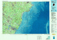
Editions of this 1985 Kittery Map
2 editions found
Other maps of this area

1888 · Newburyport
USGS Topo · 1:62,500

1888 · Haverhill
USGS Topo · 1:62,500

1890 · Haverhill
USGS Topo · 1:62,500

1890 · Newburyport
USGS Topo · 1:62,500

1891 · Portland
USGS Topo · 1:62,500

1891 · Biddeford
USGS Topo · 1:62,500

1891 · Berwick
USGS Topo · 1:62,500

1891 · Kennebunk
USGS Topo · 1:62,500

1891 · Buxton
USGS Topo · 1:62,500

1891 · Newfield
USGS Topo · 1:62,500