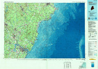
1985 Map of Kittery
USGS Topo · Published 1989About this map
The Piscataqua River forms the natural heart of this coastal boundary region, separating Portsmouth, New Hampshire, from Kittery, Maine. In the mid-1980s, the landscape is defined by the heavy footprint of the Pease Air Force Base and the academic sprawl of the University of New Hampshire at Durham. The coastline is a complex of marshes and rocky points, protected in part by the Rachel Carson National Wildlife Refuge and historic shoreline preserves like Odiorne Point State Park.
Find a feature on this map
185 named features on this map. Tap any name to fly to it.
Don’t see what you’re looking for? This feature index may not catch every label — zoom into the map to look around manually.
Map Details
Editions of this 1985 Kittery Map
2 editions found
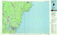
Other maps of this area

1888 · Newburyport
USGS Topo · 1:62,500

1888 · Haverhill
USGS Topo · 1:62,500

1890 · Haverhill
USGS Topo · 1:62,500

1890 · Newburyport
USGS Topo · 1:62,500

1891 · Portland
USGS Topo · 1:62,500

1891 · Biddeford
USGS Topo · 1:62,500

1891 · Berwick
USGS Topo · 1:62,500

1891 · Kennebunk
USGS Topo · 1:62,500

1891 · Buxton
USGS Topo · 1:62,500

1891 · Newfield
USGS Topo · 1:62,500