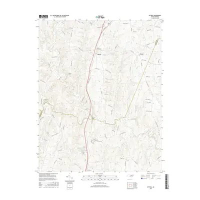
2016 Map of Kittrell
USGS Topo · Published 2016About this map
The Confederate Cem stands as a significant historical landmark near Kittrell, marking the intersection of regional memory and the local landscape. This 2016 survey illustrates the convergence of Vance, Franklin, and Granville counties, a transition zone defined by the winding course of the Tar River and its numerous tributaries. The settlement pattern is characterized by scattered rural communities like Bobbitt, connected by a network of roads named for local families and landmarks, such as Kittrell College Rd and Buffalo Mill Rd. The terrain is shaped by the drainage of Tabbs Cr and Little Buffalo Cr, with Egypt Mountain providing a distinct rise in the western portion of the sheet. Transportation infrastructure is represented by the Railroad Bridge and the small-scale Deer Run Airport, reflecting the area's mix of traditional river-and-rail proximity and modern utility.
Find a feature on this map
93 named features on this map. Tap any name to fly to it.
Don’t see what you’re looking for? This feature index may not catch every label — zoom into the map to look around manually.
Map Details
Editions of this 2016 Kittrell Map
This is the sole edition of this map. No revisions or reprints were ever made.
Other maps of this area

1943 · Creedmoor
USGS Topo · 1:62,500

1944 · Creedmoor
USGS Topo · 1:62,500

1953 · Oxford
USGS Topo · 1:62,500

1953 · Greensboro
USGS Topo · 1:250,000

1954 · Greensboro
USGS Topo · 1:250,000

1962 · Greensboro
USGS Topo · 1:250,000

1966 · Greensboro
USGS Topo · 1:250,000

1966 · Oxford
USGS Topo · 1:62,500

1970 · Vicksboro
USGS Topo · 1:24,000

1970 · Henderson
USGS Topo · 1:24,000