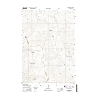
2014 Map of Kitty Creek
USGS Topo · Published 2014About this map
The Continental Divide serves as the literal and geographic spine of this high-altitude landscape, marking the boundary between Beaverhead National Forest in Montana and Salmon National Forest in Idaho. This remote frontier is defined by a dense network of mountain drainages, most notably Bloody Dick Cr and its numerous tributaries including Eunice Cr, Selway Cr, and Hopps Cr. To the north, Reservoir Lake sits near the headwaters of Lake Cr, providing a critical water source in the high timber. The presence of Pyramid Hill and deep incisions like Hughes Gulch illustrate the dramatic elevation changes common along the Montana-Idaho line. Evidence of human passage is limited to isolated forest routes such as Warm Springs Rd and Bloody Dick Rd, highlighting the area's preservation as a wilderness corridor for both state and national forest management.
Find a feature on this map
38 named features on this map. Tap any name to fly to it.
Don’t see what you’re looking for? This feature index may not catch every label — zoom into the map to look around manually.
Map Details
Editions of this 2014 Kitty Creek Map
This is the sole edition of this map. No revisions or reprints were ever made.
Other maps of this area

1955 · Dubois
USGS Topo · 1:250,000

1955 · Dillon
USGS Topo · 1:250,000

1956 · Goldstone Mtn
USGS Topo · 1:62,500

1956 · Lemhi
USGS Topo · 1:62,500

1957 · Dillon
USGS Topo · 1:250,000

1958 · Dubois
USGS Topo · 1:250,000

1958 · Dillon
USGS Topo · 1:250,000

1962 · Dillon
USGS Topo · 1:250,000

1965 · Dillon
USGS Topo · 1:250,000

1965 · Lemhi Pass
USGS Topo · 1:24,000