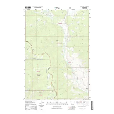
2017 Map of Kitty Creek
USGS Topo · Published 2017About this map
The Continental Divide forms the backbone of this high-elevation landscape, where the borders of Beaverhead National Forest and Salmon National Forest meet. This terrain is defined by the headwaters of numerous drainages, including Bloody Dick Cr and Kitty Cr, which flow through deep mountain valleys like Hughes Gulch. The presence of the Continental Divide NST and various loop trails such as the Warm-Springs-Agency-Loop-WT highlights the area's long-standing use for high-country transit between Idaho and Montana. To the north, Reservoir Lake serves as a prominent water feature near the convergence of Lake Cr and Bloody Dick Cr. The map preserves the names of numerous local springs and minor peaks, including Pyatt Springs and Pyramid Hill, illustrating the complex hydrology and topography along the state line.
Find a feature on this map
46 named features on this map. Tap any name to fly to it.
Don’t see what you’re looking for? This feature index may not catch every label — zoom into the map to look around manually.
Map Details
Editions of this 2017 Kitty Creek Map
This is the sole edition of this map. No revisions or reprints were ever made.
Other maps of this area

1955 · Dubois
USGS Topo · 1:250,000

1955 · Dillon
USGS Topo · 1:250,000

1956 · Goldstone Mtn
USGS Topo · 1:62,500

1956 · Lemhi
USGS Topo · 1:62,500

1957 · Dillon
USGS Topo · 1:250,000

1958 · Dubois
USGS Topo · 1:250,000

1958 · Dillon
USGS Topo · 1:250,000

1962 · Dillon
USGS Topo · 1:250,000

1965 · Dillon
USGS Topo · 1:250,000

1965 · Lemhi Pass
USGS Topo · 1:24,000