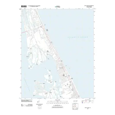
2010 Map of Kitty Hawk
USGS Topo · Published 2010About this map
The Wright Brothers Natl Monument and its accompanying First Flight Airport dominate the lower half of this coastal survey, marking the historic grounds of aviation's birth. The landscape is defined by the thin barrier island strip separating the Atlantic Ocean from the expansive Albemarle Sound. Densely gridded residential developments in Kill Devil Hills and Avalon Beach contrast with the labyrinthine marshlands of Colington Island and Hog Island. Genealogists will find several family-named burial grounds including Austin Cemetery, Baum Cemetery, and Hilltop Cemetery. The map captures the maritime infrastructure of the Outer Banks, from the recreational Kitty Hawk Pier to various sound-side access points like Sound Landing and Poor Ridge Landing.
Find a feature on this map
61 named features on this map. Tap any name to fly to it.
Don’t see what you’re looking for? This feature index may not catch every label — zoom into the map to look around manually.
Map Details
Editions of this 2010 Kitty Hawk Map
This is the sole edition of this map. No revisions or reprints were ever made.
Other maps of this area

1940 · Kitty Hawk
USGS Topo · 1:62,500

1940 · Powells Point
USGS Topo · 1:62,500

1943 · Roanoke Island
USGS Topo · 1:125,000

1946 · Eastville
USGS Topo · 1:250,000

1946 · Currituck Sound
USGS Topo · 1:250,000

1953 · Roanoke Island NE
USGS Topo · 1:24,000

1953 · Manteo
USGS Topo · 1:24,000

1953 · Manns Harbor
USGS Topo · 1:24,000

1955 · Wanchese
USGS Topo · 1:250,000

1957 · Manteo
USGS Topo · 1:250,000