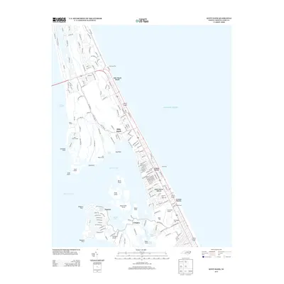
2013 Map of Kitty Hawk
USGS Topo · Published 2013About this map
The narrow Outer Banks ribbon between the Atlantic Ocean and Currituck Sound is defined here by the established coastal communities of Kitty Hawk and Kill Devil Hills. This 2013 survey illustrates the dense residential grid of the barrier island, reaching from the northern stretches of Kitty Hawk Beach down to the commemorative landscape around Kill Devil Hill. The area's aviation legacy is anchored by the First Flight Airport, situated just west of the developed shoreline.
Find a feature on this map
186 named features on this map. Tap any name to fly to it.
Don’t see what you’re looking for? This feature index may not catch every label — zoom into the map to look around manually.
Map Details
Editions of this 2013 Kitty Hawk Map
This is the sole edition of this map. No revisions or reprints were ever made.
Other maps of this area

1940 · Kitty Hawk
USGS Topo · 1:62,500

1940 · Powells Point
USGS Topo · 1:62,500

1943 · Roanoke Island
USGS Topo · 1:125,000

1946 · Eastville
USGS Topo · 1:250,000

1946 · Currituck Sound
USGS Topo · 1:250,000

1953 · Roanoke Island NE
USGS Topo · 1:24,000

1953 · Manteo
USGS Topo · 1:24,000

1953 · Manns Harbor
USGS Topo · 1:24,000

1955 · Wanchese
USGS Topo · 1:250,000

1957 · Manteo
USGS Topo · 1:250,000