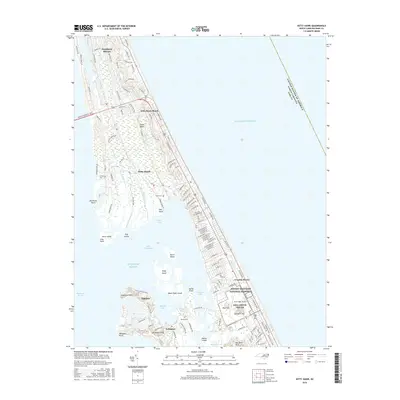
2016 Map of Kitty Hawk
USGS Topo · Published 2016About this map
The Wright Brothers National Memorial and the adjacent First Flight Airport dominate the center of this coastal survey, marking the historic site where aviation began. To the south and west, the fragmented geography of Colington Island and Baum Point Island reveal a complex network of marshes and smaller landmasses like Stove Island and Hog Island reaching into Kitty Hawk Bay. This decade-old record shows the dense residential growth of Kill Devil Hills and Southern Shores along the thin barrier strand, contrasting with the preservation of tidal waterways like Jean Guite Creek and Dick Pond Cr. Local family history is preserved in several small burial sites, including Austin Cem, Baum Cem, and Hilltop Cem, scattered across the islands and main peninsula.
Find a feature on this map
42 named features on this map. Tap any name to fly to it.
Don’t see what you’re looking for? This feature index may not catch every label — zoom into the map to look around manually.
Map Details
Editions of this 2016 Kitty Hawk Map
This is the sole edition of this map. No revisions or reprints were ever made.
Other maps of this area

1940 · Kitty Hawk
USGS Topo · 1:62,500

1940 · Powells Point
USGS Topo · 1:62,500

1943 · Roanoke Island
USGS Topo · 1:125,000

1946 · Eastville
USGS Topo · 1:250,000

1946 · Currituck Sound
USGS Topo · 1:250,000

1953 · Roanoke Island NE
USGS Topo · 1:24,000

1953 · Manteo
USGS Topo · 1:24,000

1953 · Manns Harbor
USGS Topo · 1:24,000

1955 · Wanchese
USGS Topo · 1:250,000

1957 · Manteo
USGS Topo · 1:250,000