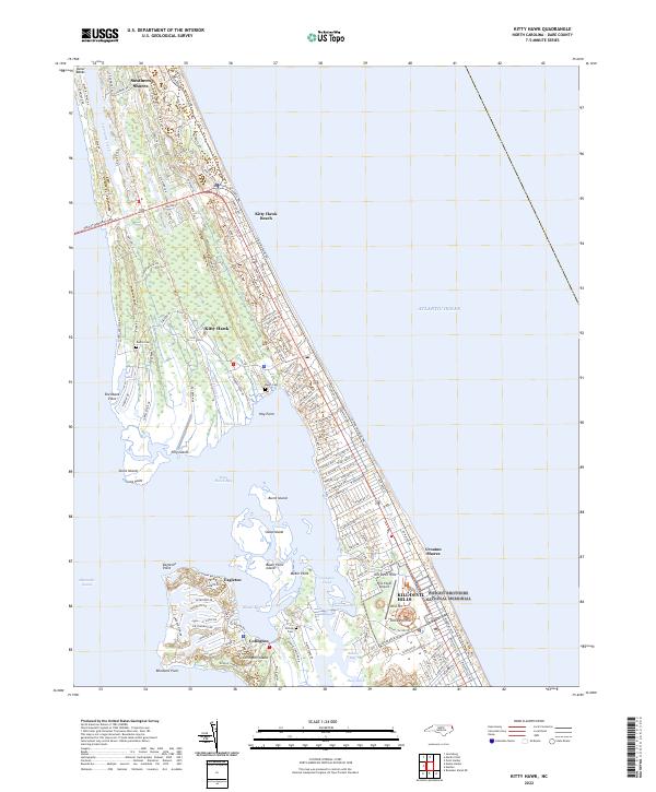
2022 Map of Kitty Hawk
USGS Topo · Published 2022About this map
Wright Brothers National Memorial and the adjacent First Flight Airport anchor the southern portion of this coastal survey, marking the historic grounds where aviation began. The terrain of the Outer Banks is intricately detailed, showing the residential expansion across Kitty Hawk, Kill Devil Hills, and Southern Shores. Inland from the Atlantic Ocean, the map reveals a complex network of sounds and bays, including Kitty Hawk Bay and Baum Bay, which surround Colington Island. Genealogists may find value in the location of family-named landmarks and resting places such as Austin Cem near Jean Guite Creek and Baum Cem further south. The transition from the dense street grids of Kitty Hawk Beach to the more dispersed settlements of Eagleton and Colington reflects the varied development patterns of this narrow barrier island landscape.
Find a feature on this map
144 named features on this map. Tap any name to fly to it.
Don’t see what you’re looking for? This feature index may not catch every label — zoom into the map to look around manually.
Map Details
Editions of this 2022 Kitty Hawk Map
This is the sole edition of this map. No revisions or reprints were ever made.
Other maps of this area

1940 · Kitty Hawk
USGS Topo · 1:62,500

1940 · Powells Point
USGS Topo · 1:62,500

1943 · Roanoke Island
USGS Topo · 1:125,000

1946 · Eastville
USGS Topo · 1:250,000

1946 · Currituck Sound
USGS Topo · 1:250,000

1953 · Roanoke Island NE
USGS Topo · 1:24,000

1953 · Manteo
USGS Topo · 1:24,000

1953 · Manns Harbor
USGS Topo · 1:24,000

1955 · Wanchese
USGS Topo · 1:250,000

1957 · Manteo
USGS Topo · 1:250,000