
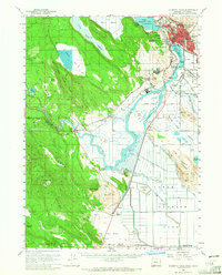
1957 Map of Klamath Falls
USGS Topo · Published 1960About this map
Klamath Falls serves as the industrial and population hub of this southern Oregon landscape, where the waters of Upper Klamath Lake flow into Lake Ewauna and the Klamath River. The map captures a moment when the regional economy was heavily reliant on timber and rail, evidenced by the presence of a Sawmill, a Quarry, and a dense network of lines belonging to the Southern Pacific, Oregon California and Eastern, and Great Northern RR. Beyond the urban core, the landscape transitions into the agricultural drainage basins of the Klamath Strait and Lower Klamath Lake.
Find a feature on this map
49 named features on this map. Tap any name to fly to it.
Don’t see what you’re looking for? This feature index may not catch every label — zoom into the map to look around manually.
Map Details
Editions of this 1957 Klamath Falls Map
2 editions found
Other maps of this area

1886 · Modoc Lava Bed
USGS Topo · 1:250,000

1886 · Shasta
USGS Topo · 1:250,000

1889 · Klamath
USGS Topo · 1:250,000

1891 · Ashland
USGS Topo · 1:250,000

1892 · Modoc Lava-Bed
USGS Topo · 1:250,000

1893 · Ashland
USGS Topo · 1:250,000

1894 · Klamath
USGS Topo · 1:250,000

1894 · Shasta
USGS Topo · 1:250,000

1897 · Ashland
USGS Topo · 1:250,000

1934 · Macdoel
USGS Topo · 1:96,000