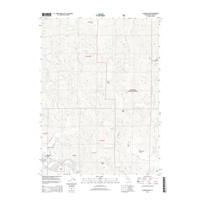
2015 Map of Klamath Glen
USGS Topo · Published 2015About this map
The Klamath River winds through the southwestern corner of this coastal mountain terrain, providing a focal point for the small settlements of Klamath Glen and Scaath. Much of the landscape is dominated by the dense, protected wilderness of the Six Rivers National Forest, where steep ridges like Starwein Ridge and peaks including Rattlesnake Mtn rise above deep drainages. This 2015 survey shows a rural infrastructure concentrated in the Turwar Valley, where Andy Mc Beth Airport serves as a remote aviation link. Local transport is limited to narrow routes such as Klamath Glen Rd and Red Mountain Rd, which snake through the hills toward high points like Red Mtn. For the researcher, the map preserves the names of distinct local features including Starwein Flat, Red Mountain Meadow, and Broken Rock Spring, documenting the contemporary state of these isolated Northern California communities.
Find a feature on this map
38 named features on this map. Tap any name to fly to it.
Don’t see what you’re looking for? This feature index may not catch every label — zoom into the map to look around manually.
Map Details
Editions of this 2015 Klamath Glen Map
This is the sole edition of this map. No revisions or reprints were ever made.
Other maps of this area

1922 · Preston Peak
USGS Topo · 1:125,000

1925 · Hoopa
USGS Topo · 1:125,000

1929 · Crescent City
USGS Topo · 1:125,000

1945 · Ship Mountain
USGS Topo · 1:62,500

1945 · Orick
USGS Topo · 1:62,500

1945 · Requa
USGS Topo · 1:62,500

1945 · Tectah Creek
USGS Topo · 1:62,500

1948 · Weed
USGS Topo · 1:250,000

1949 · Eureka
USGS Topo · 1:250,000

1950 · Weed
USGS Topo · 1:250,000