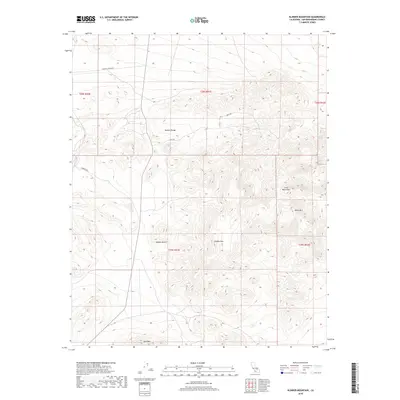
2018 Map of Klinker Mountain
USGS Topo · Published 2018About this map
The Mojave Desert terrain dominates this 2018 survey of San Bernardino County, where the stark elevation changes of the Lava Mountains and Summit Range define the local geography. Significant peaks including Klinker Mtn, Dome Mtn, and Red Mtn anchor the landscape, providing essential landmarks for navigation in this arid environment. The presence of Bedrock Spring in the northeast highlights a rare water source within the high desert, which historically dictated human movement and survival in the region. Transportation across these basins is limited to a sparse network of thoroughfares, such as Searles Station Rd, Savoy Rd, and Sardinia Rd, which trace the flats between the prominent mountain ranges. The map reveals the intricate contouring of the desert's volcanic and metamorphic formations, illustrating the geological character of the northwestern edge of the county.
Find a feature on this map
15 named features on this map. Tap any name to fly to it.
Don’t see what you’re looking for? This feature index may not catch every label — zoom into the map to look around manually.
Map Details
Editions of this 2018 Klinker Mountain Map
This is the sole edition of this map. No revisions or reprints were ever made.
Other maps of this area

1903 · Randsburg
USGS Topo · 1:62,500

1911 · Randsburg
USGS Topo · 1:62,500

1912 · Randsburg
USGS Topo · 1:62,500

1915 · Searles Lake
USGS Topo · 1:250,000

1947 · Trona
USGS Topo · 1:250,000

1948 · Trona
USGS Topo · 1:250,000

1949 · Searles Lake
USGS Topo · 1:62,500

1950 · Searles Lake
USGS Topo · 1:62,500

1953 · Ridgecrest
USGS Topo · 1:62,500

1953 · Trona
USGS Topo · 1:250,000