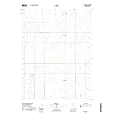
2019 Map of Klug Ranch
USGS Topo · Published 2019About this map
Klug Ranch and the adjacent Klug Lake anchor the northeastern landscape of this Weld County agricultural region in 2019. This area of eastern Colorado is defined by its extensive water management system, vital for maintaining the high plains farm economy. The Neres Canal and W Neres Canal carve through the western sections, while Box Elder Cr meanders southward across the central terrain. The landscape is organized by a meticulous grid of county roads, such as Co RD 49 and Co RD 53, which provide access to the rural sections and isolated ranching homesteads. The topographical detail reveals a series of subtle drainage patterns and wetlands that persist in this semi-arid environment, illustrating the intersection of natural hydrology and human-engineered irrigation.
Find a feature on this map
25 named features on this map. Tap any name to fly to it.
Don’t see what you’re looking for? This feature index may not catch every label — zoom into the map to look around manually.
Map Details
Editions of this 2019 Klug Ranch Map
This is the sole edition of this map. No revisions or reprints were ever made.
Other maps of this area

1902 · Greeley
USGS Topo · 1:125,000

1949 · Hudson
USGS Topo · 1:24,000

1950 · Tampa
USGS Topo · 1:24,000

1950 · Keenesburg
USGS Topo · 1:24,000

1950 · Prospect Valley
USGS Topo · 1:24,000

1950 · Klug Ranch
USGS Topo · 1:24,000

1950 · Valley View School
USGS Topo · 1:24,000

1950 · Hardin
USGS Topo · 1:24,000
1950 · Milton Reservoir
USGS Topo · 1:24,000

1950 · La Salle
USGS Topo · 1:24,000