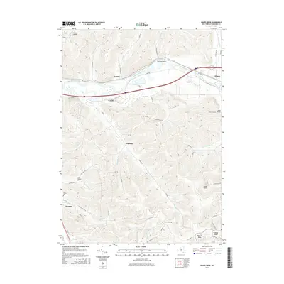
2016 Map of Knapp Creek
USGS Topo · Published 2016About this map
The Allegheny River valley forms the spine of this landscape, where the flat river plains contrast sharply with the dissected plateaus of the Southern Tier. This era shows the developed corridors along Vandalia and Allegany, where river and road networks have long dictated the flow of commerce and transit. Away from the main valley, the terrain is defined by a series of named hollows and creek basins, such as Chipmunk and Lony Hollow, which represent the more secluded agricultural and residential pockets of the county.
Find a feature on this map
71 named features on this map. Tap any name to fly to it.
Don’t see what you’re looking for? This feature index may not catch every label — zoom into the map to look around manually.
Map Details
Editions of this 2016 Knapp Creek Map
This is the sole edition of this map. No revisions or reprints were ever made.
Other maps of this area

1898 · Olean
USGS Topo · 1:62,500

1900 · Salamanca
USGS Topo · 1:62,500

1924 · Bradford
USGS Topo · 1:62,500

1926 · Bradford
USGS Topo · 1:62,500

1933 · Smethport
USGS Topo · 1:62,500

1937 · Smethport
USGS Topo · 1:62,500

1938 · Salamanca
USGS Topo · 1:62,500

1938 · Olean
USGS Topo · 1:62,500

1941 · Bradford
USGS Topo · 1:62,500

1943 · Olean
USGS Topo · 1:62,500