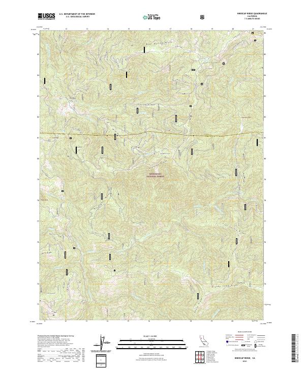
2021 Map of Kneecap Ridge
USGS Topo · Published 2021About this map
Mendocino National Forest defines this high-elevation landscape along the boundary of Lake and Glenn counties. The terrain is characterized by a series of prominent ridges, including Spanish Ridge, Bear Wallow Ridge, and the namesake Kneecap Ridge, which divide numerous drainage basins. Major watercourses like the Eel River and Black Butte River cut through the topography, joined by smaller tributaries such as Corbin Cr and Anderson Cr. This 2021 survey details a network of forest access routes like the Neecap-Cabbage Patch road and Kneecap Tie, which navigate between peaks such as Round Mtn and High Point. The presence of named features like Gravelly Flat and The Basin indicates the varied geomorphology of this protected wilderness area, which remains largely dominated by its natural hydrography and steep relief.
Find a feature on this map
42 named features on this map. Tap any name to fly to it.
Don’t see what you’re looking for? This feature index may not catch every label — zoom into the map to look around manually.
Map Details
Editions of this 2021 Kneecap Ridge Map
This is the sole edition of this map. No revisions or reprints were ever made.
Other maps of this area

1919 · Elk Creek
USGS Topo · 1:62,500

1922 · Hullville
USGS Topo · 1:62,500

1948 · Elk Creek
USGS Topo · 1:62,500

1951 · Lake Pillsbury
USGS Topo · 1:62,500

1951 · Stonyford
USGS Topo · 1:62,500

1952 · Hull Mountain
USGS Topo · 1:62,500

1957 · Elk Creek
USGS Topo · 1:62,500

1957 · Ukiah
USGS Topo · 1:250,000

1960 · Ukiah
USGS Topo · 1:250,000

1967 · Plaskett Ridge
USGS Topo · 1:24,000