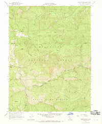
1967 Map of Kneecap Ridge
USGS Topo · Published 1969About this map
Mendocino National Forest defines this mountainous area of Lake and Glenn Counties, captured during a 1967 field check. The landscape is dominated by a series of parallel elevations including Kneecap Ridge, Black Ridge, and Brushy Ridge, which direct the drainage of numerous seasonal and perennial creeks. The Eel River cuts through the southwestern corner of the quadrangle, serving as a primary water source alongside remote features like Kneecap Spring and Five Spring.
Find a feature on this map
38 named features on this map. Tap any name to fly to it.
Don’t see what you’re looking for? This feature index may not catch every label — zoom into the map to look around manually.
Map Details
Editions of this 1967 Kneecap Ridge Map
This is the sole edition of this map. No revisions or reprints were ever made.
Other maps of this area

1919 · Elk Creek
USGS Topo · 1:62,500

1922 · Hullville
USGS Topo · 1:62,500

1948 · Elk Creek
USGS Topo · 1:62,500

1951 · Lake Pillsbury
USGS Topo · 1:62,500

1951 · Stonyford
USGS Topo · 1:62,500

1952 · Hull Mountain
USGS Topo · 1:62,500

1957 · Elk Creek
USGS Topo · 1:62,500

1957 · Ukiah
USGS Topo · 1:250,000

1960 · Ukiah
USGS Topo · 1:250,000

1967 · Plaskett Ridge
USGS Topo · 1:24,000