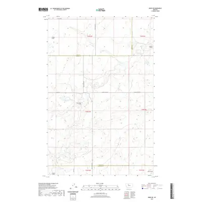
2020 Map of Knees NE
USGS Topo · Published 2020About this map
St Olaf Church stands as a primary landmark in this expanse of the Montana plains, situated just south of the border between Liberty and Toole counties. The landscape is defined by the complex drainage systems of the northern high plains, where the Pondera Coulee and Dead Indian Coulee cut deep, winding paths through the terrain. These natural features, along with Shotgun Slough and Basin Coulee, dictate the movement across the land, influencing the placement of local thoroughfares like Selma Rd and Dugout Coulee Rd.
Find a feature on this map
18 named features on this map. Tap any name to fly to it.
Don’t see what you’re looking for? This feature index may not catch every label — zoom into the map to look around manually.
Map Details
Editions of this 2020 Knees NE Map
This is the sole edition of this map. No revisions or reprints were ever made.
Other maps of this area

1954 · Shelby
USGS Topo · 1:250,000

1958 · Shelby
USGS Topo · 1:250,000

1970 · Carlson Coulee
USGS Topo · 1:24,000

1970 · Knees NE
USGS Topo · 1:24,000

1970 · Knees
USGS Topo · 1:24,000

1970 · Sollid School
USGS Topo · 1:24,000

1970 · Pondera School
USGS Topo · 1:24,000
1970 · Faris School
USGS Topo · 1:24,000
1970 · Mc Bridy Spring
USGS Topo · 1:24,000
1970 · Denson Ranch
USGS Topo · 1:24,000