
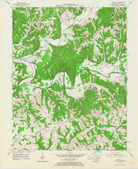
1954 Map of Knifley
USGS Topo · Published 1955About this map
The Green River meanders across this mid-century landscape, carving deep valleys through high ridges like Robinson Ridge and Burton Ridge. This rural stretch of Adair County is characterized by a dense network of upland school districts and family-named landmarks, reflecting a era of localized community life before the consolidation of rural services. Small farming settlements such as Knifley and Neatsville serve as central points, while the surrounding hills are dotted with foundational institutions including Little Cake Sch, Fairview Sch, and Bearwallow Ch.
Find a feature on this map
58 named features on this map. Tap any name to fly to it.
Don’t see what you’re looking for? This feature index may not catch every label — zoom into the map to look around manually.
Map Details
Editions of this 1954 Knifley Map
2 editions found
Other maps of this area

1952 · Clementsville
USGS Topo · 1:24,000

1952 · Mannsville
USGS Topo · 1:24,000

1953 · Campbellsville
USGS Topo · 1:24,000

1953 · Montpelier
USGS Topo · 1:24,000

1953 · Dunnville
USGS Topo · 1:24,000

1953 · Cane Valley
USGS Topo · 1:24,000

1954 · Columbia
USGS Topo · 1:24,000

1954 · Russell Springs
USGS Topo · 1:24,000

1957 · Winchester
USGS Topo · 1:250,000

1960 · Winchester
USGS Topo · 1:250,000