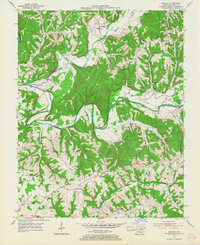
1954 Map of Knifley
USGS Topo · Published 1967About this map
The Green River carves a deep, winding path through this portion of Adair County, shaping a landscape defined by prominent ridges and narrow creek bottoms. In the mid-1950s, small rural centers like Knifley and Neatsville anchored the community, connected by a network of unimproved and light-duty roads that followed the contours of the land. The distribution of numerous country schools, such as White Oak Sch and Little Cake Sch, alongside churches like Beulah Chapel and Bearwallow Ch, illustrates a decentralized settlement pattern where local life was organized around small, neighborhood-scale institutions.
Find a feature on this map
63 named features on this map. Tap any name to fly to it.
Don’t see what you’re looking for? This feature index may not catch every label — zoom into the map to look around manually.
Map Details
Editions of this 1954 Knifley Map
2 editions found
Other maps of this area

1952 · Clementsville
USGS Topo · 1:24,000

1952 · Mannsville
USGS Topo · 1:24,000

1953 · Campbellsville
USGS Topo · 1:24,000

1953 · Montpelier
USGS Topo · 1:24,000

1953 · Dunnville
USGS Topo · 1:24,000

1953 · Cane Valley
USGS Topo · 1:24,000

1954 · Knifley
USGS Topo · 1:24,000

1954 · Columbia
USGS Topo · 1:24,000

1954 · Russell Springs
USGS Topo · 1:24,000

1957 · Winchester
USGS Topo · 1:250,000