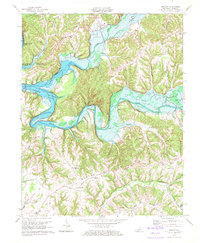
1970 Map of Knifley
USGS Topo · Published 1972About this map
Green River Lake dominates this 1970 landscape, its waters backing into the deep valleys of White Oak Creek and Casey Creek. The map records the area just as controlled inundation transformed the local geography, showing the Green River winding below the high elevations of Burton Ridge. This transitional period captures established upland communities like Purdy and Christine alongside the emerging recreational landscape. Small rural centers such as Knifley and Neatsville serve as focal points for a network of ridges and hollows defined by family-named landmarks and country churches. Genealogists can trace local roots through numerous sites like Parker Chapel, Damron Cem, and the Robinson Chapel located near the headwaters of the newly formed lake. The presence of the Lookout Tower and specialized routes like Allen Cemetery Rd reflect the enduring patterns of forest management and cemetery access in Adair County.
Find a feature on this map
51 named features on this map. Tap any name to fly to it.
Don’t see what you’re looking for? This feature index may not catch every label — zoom into the map to look around manually.
Map Details
Editions of this 1970 Knifley Map
2 editions found
Other maps of this area

1952 · Clementsville
USGS Topo · 1:24,000

1952 · Mannsville
USGS Topo · 1:24,000

1953 · Campbellsville
USGS Topo · 1:24,000

1953 · Montpelier
USGS Topo · 1:24,000

1953 · Dunnville
USGS Topo · 1:24,000

1953 · Cane Valley
USGS Topo · 1:24,000

1954 · Knifley
USGS Topo · 1:24,000

1954 · Columbia
USGS Topo · 1:24,000

1954 · Russell Springs
USGS Topo · 1:24,000

1957 · Winchester
USGS Topo · 1:250,000