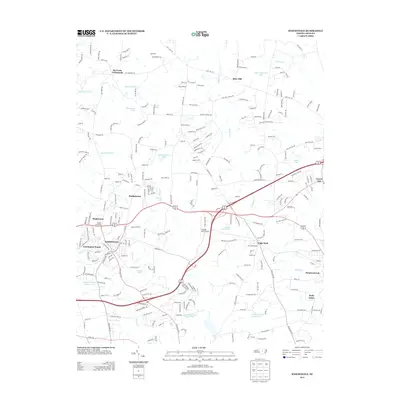
2013 Map of Knightdale
USGS Topo · Published 2013About this map
Knightdale and its surrounding suburbs in Wake County reflect a landscape of rapid residential growth intertwined with long-standing rural crossroads. The Norfolk Southern railway line cuts through the heart of the main settlement, a corridor that shaped the town's early development. Outside the primary hub, smaller communities like Eagle Rock and the interestingly named Lizard Lick maintain their distinct identities amidst a network of newer subdivisions such as Carrington Woods and Pebblebrook.
Find a feature on this map
250 named features on this map. Tap any name to fly to it.
Don’t see what you’re looking for? This feature index may not catch every label — zoom into the map to look around manually.
Map Details
Editions of this 2013 Knightdale Map
This is the sole edition of this map. No revisions or reprints were ever made.
Other maps of this area

1943 · Raleigh
USGS Topo · 1:62,500

1951 · Raleigh
USGS Topo · 1:62,500

1953 · Raleigh
USGS Topo · 1:250,000

1954 · Raleigh
USGS Topo · 1:250,000

1964 · Garner
USGS Topo · 1:24,000

1964 · Flowers
USGS Topo · 1:24,000

1964 · Selma
USGS Topo · 1:62,500

1964 · Clayton
USGS Topo · 1:24,000

1964 · Garner
USGS Topo · 1:62,500

1967 · Knightdale
USGS Topo · 1:24,000