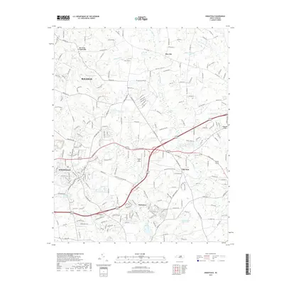
2019 Map of Knightdale
USGS Topo · Published 2019About this map
Lizard Lick and Eagle Rock anchor the eastern landscape of this Wake County survey, where the suburban expansion of Raleigh and Knightdale meets a network of established creeks and local landmarks. The map documents a complex water system including the Crabtree Cr Water Shed, Beaverdam Creek, and the distinctive Buffalo Creek Cypress Swamp. Small aviation interests are represented by the Raleigh East Airport, situated near the junction of Knightdale Blvd and the Wendell Falls Pkwy.
Find a feature on this map
186 named features on this map. Tap any name to fly to it.
Don’t see what you’re looking for? This feature index may not catch every label — zoom into the map to look around manually.
Map Details
Editions of this 2019 Knightdale Map
This is the sole edition of this map. No revisions or reprints were ever made.
Other maps of this area

1943 · Raleigh
USGS Topo · 1:62,500

1951 · Raleigh
USGS Topo · 1:62,500

1953 · Raleigh
USGS Topo · 1:250,000

1954 · Raleigh
USGS Topo · 1:250,000

1964 · Garner
USGS Topo · 1:24,000

1964 · Flowers
USGS Topo · 1:24,000

1964 · Selma
USGS Topo · 1:62,500

1964 · Clayton
USGS Topo · 1:24,000

1964 · Garner
USGS Topo · 1:62,500

1967 · Knightdale
USGS Topo · 1:24,000