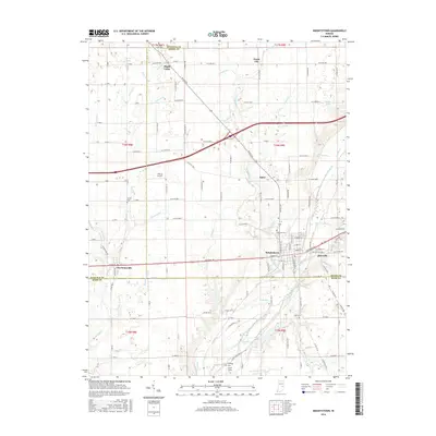
2016 Map of Knightstown
USGS Topo · Published 2016About this map
The Big Blue River snakes through the landscape of eastern Indiana, anchoring a network of historic settlements and rural crossroads near the border of Henry, Hancock, and Rush counties. This area is defined by the development along the National Road corridor, where Knightstown and Raysville sit just east of Charlottesville. The town grids and surrounding farmsteads are intersected by numerous small waterways, including Sixmile Cr, Montgomery Cr, and Threemile Cr, which historically dictated the placement of early mills and local infrastructure.
Find a feature on this map
133 named features on this map. Tap any name to fly to it.
Don’t see what you’re looking for? This feature index may not catch every label — zoom into the map to look around manually.
Map Details
Editions of this 2016 Knightstown Map
This is the sole edition of this map. No revisions or reprints were ever made.
Other maps of this area

1949 · New Castle West
USGS Topo · 1:24,000

1950 · Dunreith
USGS Topo · 1:24,000

1953 · Pendleton
USGS Topo · 1:24,000

1953 · Cincinnati
USGS Topo · 1:250,000

1956 · Cleveland
USGS Topo · 1:24,000

1956 · Morristown
USGS Topo · 1:24,000

1957 · Cincinnati
USGS Topo · 1:250,000

1959 · Mays
USGS Topo · 1:24,000

1960 · New Castle West
USGS Topo · 1:24,000
1960 · Carthage
USGS Topo · 1:24,000