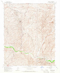
1965 Map of Knob Hill
USGS Topo · Published 1966About this map
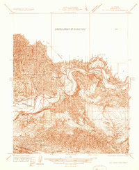
Mt Poso Oil Field and Round Mtn Oil Field dominate this part of the Kern County landscape, illustrating the mid-century industrial infrastructure of the region. The terrain is defined by a series of deep drainages including Granite Canyon, Adobe Canyon, and Sycamore Canyon, which carve through the high ground toward the Poso Creek valley. Human habitation is sparse, centered on small settlements like Halfway House and the namesake Knob Hill, alongside technical landmarks such as the Poso Canal. The mapping details a complex network of utility features, including numerous Water Tanks, Oil Sumps, and a Substation, reflecting the intense resource extraction occurring in the hills. Distinctive geological markers like Chalk Cliff and Mon Bluff provide navigational anchors in an area otherwise characterized by repetitive ridgelines and industrial access roads.
Find a feature on this map
30 named features on this map. Tap any name to fly to it.
Don’t see what you’re looking for? This feature index may not catch every label — zoom into the map to look around manually.
Map Details
Editions of this 1965 Knob Hill Map
4 editions found
Other maps of this area

1906 · Bakersfield
USGS Topo · 1:62,500

1910 · Buena Vista Lake
USGS Topo · 1:125,000

1912 · Buena Vista Lake
USGS Topo · 1:125,000

1914 · Caliente
USGS Topo · 1:125,000

1930 · Oildale
USGS Topo · 1:31,680

1931 · Deepwell Ranch
USGS Topo · 1:31,680

1932 · North of Oildale
USGS Topo · 1:31,680

1932 · Woody
USGS Topo · 1:62,500
1933 · Oil Center
USGS Topo · 1:31,680

1935 · Woody
USGS Topo · 1:62,500