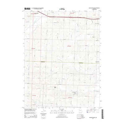
2014 Map of Knob Noster NW
USGS Topo · Published 2014About this map
Higginsville anchors the northwest corner of this West Central Missouri landscape, where the rural terrain transitions from the developed corridor of Old Highway 40 into a complex network of agricultural roads and winding creek beds. The map illustrates a distinctive drainage pattern defined by Mulkey Cr and Flagstaff Cr, which carve through the land toward the southern border. Near the center, the community of Mount Olive and the southern settlement of Ernestville reflect the area's long-standing rural identity.
Find a feature on this map
49 named features on this map. Tap any name to fly to it.
Don’t see what you’re looking for? This feature index may not catch every label — zoom into the map to look around manually.
Map Details
Editions of this 2014 Knob Noster NW Map
This is the sole edition of this map. No revisions or reprints were ever made.
Other maps of this area

1885 · Warrensburg
USGS Topo · 1:125,000

1887 · Warrensburg
USGS Topo · 1:125,000

1889 · Lexington
USGS Topo · 1:125,000

1894 · Warrensburg
USGS Topo · 1:125,000

1917 · Knobnoster
USGS Topo · 1:62,500

1947 · Jefferson City
USGS Topo · 1:250,000

1949 · Mayview
USGS Topo · 1:24,000

1950 · Mayview
USGS Topo · 1:24,000

1951 · Alma
USGS Topo · 1:24,000
1951 · Higginsville
USGS Topo · 1:24,000