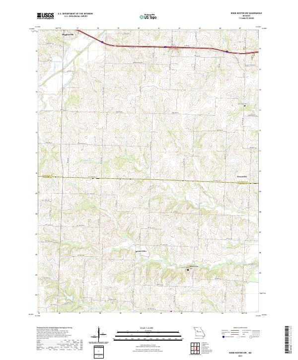
2021 Map of Knob Noster NW
USGS Topo · Published 2021About this map
Mount Olive and Ernestville serve as central points in this rural landscape spanning the Lafayette and Johnson County line. The terrain is defined by a dense network of watercourses, including the winding Mulkey Cr and the unique path of the Old Channel Davis Cr, which reveal the hydrological history of the region. Local heritage is preserved in landmarks such as New Hope Cem and Foster Cem, while the southern portion of the area features the distinct prominence of Rattlesnake Hill. Near the edge of Higginsville, the map transitions from agricultural plots to more structured road grids. A small section of Lake Rajastka sits in the southwest, anchoring a region where names like Flagstaff Cr and N Blackjack Cr reflect a long-standing relationship with the local creeks and tributaries.
Find a feature on this map
75 named features on this map. Tap any name to fly to it.
Don’t see what you’re looking for? This feature index may not catch every label — zoom into the map to look around manually.
Map Details
Editions of this 2021 Knob Noster NW Map
This is the sole edition of this map. No revisions or reprints were ever made.
Other maps of this area

1885 · Warrensburg
USGS Topo · 1:125,000

1887 · Warrensburg
USGS Topo · 1:125,000

1889 · Lexington
USGS Topo · 1:125,000

1894 · Warrensburg
USGS Topo · 1:125,000

1917 · Knobnoster
USGS Topo · 1:62,500

1947 · Jefferson City
USGS Topo · 1:250,000

1949 · Mayview
USGS Topo · 1:24,000

1950 · Mayview
USGS Topo · 1:24,000

1951 · Alma
USGS Topo · 1:24,000
1951 · Higginsville
USGS Topo · 1:24,000