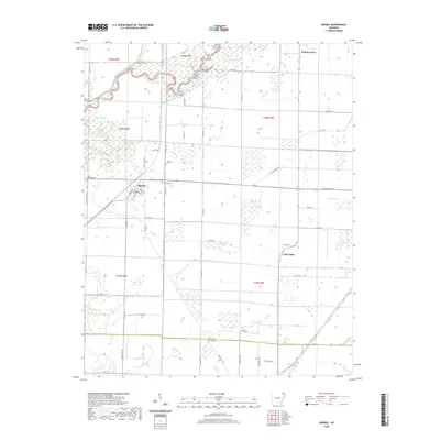
2020 Map of Knobel
USGS Topo · Published 2020About this map
Knobel and the surrounding river bottoms of Northeast Arkansas are defined by an intricate network of natural waterways and early 20th-century drainage engineering. The Black River winds through the northwestern corner, giving way to a landscape of wetlands like Gum Slough and East Slough. To the south, the Clay Co Greene Co line marks the transition into the southern reaches of this survey, where the heavy work of land reclamation is visible through the Kramer Ditch and Cache River Ditch Number 1.
Find a feature on this map
55 named features on this map. Tap any name to fly to it.
Don’t see what you’re looking for? This feature index may not catch every label — zoom into the map to look around manually.
Map Details
Editions of this 2020 Knobel Map
This is the sole edition of this map. No revisions or reprints were ever made.
Other maps of this area

1935 · Rector
USGS Topo · 1:62,500

1935 · Knobel
USGS Topo · 1:62,500

1940 · Gainesville
USGS Topo · 1:62,500

1940 · Marmaduke
USGS Topo · 1:62,500

1941 · Knobel
USGS Topo · 1:62,500

1957 · Poplar Bluff
USGS Topo · 1:250,000

1958 · Marmaduke
USGS Topo · 1:62,500

1958 · Gainesville
USGS Topo · 1:62,500

1958 · Rector
USGS Topo · 1:62,500

1959 · Poplar Bluff
USGS Topo · 1:250,000