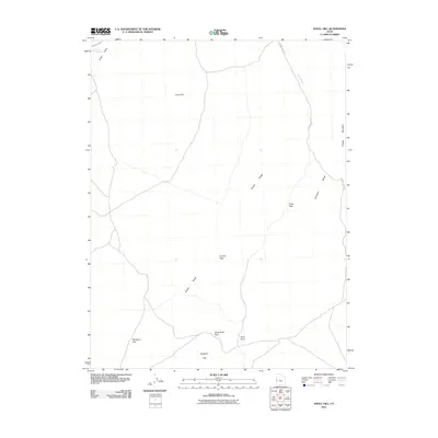
2011 Map of Knoll Hill
USGS Topo · Published 2011About this map
Snake Valley and the surrounding high desert terrain dominate this western Utah landscape, where the Conger Range and Confusion Range meet. The geography is defined by a series of critical mountain gaps used for navigation, including Coyote Pass, Cedar Pass, and Okelberry Pass. These corridors, along with Toms Knoll Pass, illustrate the historical movement patterns through the Great Basin's basin-and-range topography. Water sources are exceptionally sparse in this arid environment, making features like Horse Trap Spring in the northwest corner significant landmarks for both wildlife and early travelers. Local transit is managed by primitive routes such as Browns Wash Rd and the path of Old 6 and 50, which trace the low-lying drainage of Browns Wash beneath the peaks of Knoll Hill and Conger Mountain.
Find a feature on this map
15 named features on this map. Tap any name to fly to it.
Don’t see what you’re looking for? This feature index may not catch every label — zoom into the map to look around manually.
Map Details
Editions of this 2011 Knoll Hill Map
This is the sole edition of this map. No revisions or reprints were ever made.
Other maps of this area

1908 · Fish Springs
USGS Topo · 1:250,000

1910 · Fish Springs
USGS Topo · 1:250,000

1953 · Delta
USGS Topo · 1:250,000

1958 · Delta
USGS Topo · 1:250,000

1959 · Cowboy Pass
USGS Topo · 1:62,500

1960 · Conger Range
USGS Topo · 1:62,500

1960 · Gandy
USGS Topo · 1:62,500

1960 · Conger Mountain
USGS Topo · 1:62,500

1962 · Delta
USGS Topo · 1:250,000
1981 · Tule Valley
USGS Topo · 1:100,000