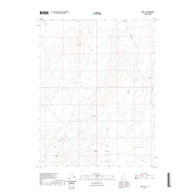
2023 Map of Knoll Hill
USGS Topo · Published 2023About this map
Confusion Range and the Conger Range dominate this desert landscape in western Millard County, where a series of mountain passes provide the primary routes through the complex topography. The map illustrates a high-altitude basin-and-range environment characterized by prominent landmarks like Knoll Hill and Conger Mtn. For researchers of western geography, the document meticulously details the relationship between these peaks and the low-lying Buckskin Hills. Natural water sources are scarce, with Horse Trap Spring in the northwest and the drainage of Browns Wash serving as critical features. Remote access is defined by the winding Browns Wash Rd, which navigates through gaps like Cedar Pass and Coyote Pass. Other notable crossings include Okelberry Pass and Toms Knoll Pass, the latter situated near the distinct summit of Toms Knoll.
Find a feature on this map
13 named features on this map. Tap any name to fly to it.
Don’t see what you’re looking for? This feature index may not catch every label — zoom into the map to look around manually.
Map Details
Editions of this 2023 Knoll Hill Map
This is the sole edition of this map. No revisions or reprints were ever made.
Other maps of this area

1908 · Fish Springs
USGS Topo · 1:250,000

1910 · Fish Springs
USGS Topo · 1:250,000

1953 · Delta
USGS Topo · 1:250,000

1958 · Delta
USGS Topo · 1:250,000

1959 · Cowboy Pass
USGS Topo · 1:62,500

1960 · Conger Range
USGS Topo · 1:62,500

1960 · Gandy
USGS Topo · 1:62,500

1960 · Conger Mountain
USGS Topo · 1:62,500

1962 · Delta
USGS Topo · 1:250,000
1981 · Tule Valley
USGS Topo · 1:100,000