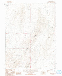
1991 Map of Knoll Hill
USGS Topo · Published 1991About this map
Snake Valley and the northern reaches of the Conger Range define this high-desert landscape in western Millard County. The topography is dominated by dramatic elevation changes, notably at Knoll Hill and the adjacent Confusion Range. Transport and travel in this arid environment are dictated by narrow gaps in the mountains, including Coyote Pass and Cedar Pass. The presence of Horse Trap Spring in the northwest suggests the vital importance of water sources in a region characterized by ephemeral drainages like Browns Wash.
Find a feature on this map
15 named features on this map. Tap any name to fly to it.
Don’t see what you’re looking for? This feature index may not catch every label — zoom into the map to look around manually.
Map Details
Editions of this 1991 Knoll Hill Map
This is the sole edition of this map. No revisions or reprints were ever made.
Other maps of this area

1908 · Fish Springs
USGS Topo · 1:250,000

1910 · Fish Springs
USGS Topo · 1:250,000

1953 · Delta
USGS Topo · 1:250,000

1958 · Delta
USGS Topo · 1:250,000

1959 · Cowboy Pass
USGS Topo · 1:62,500

1960 · Conger Range
USGS Topo · 1:62,500

1960 · Gandy
USGS Topo · 1:62,500

1960 · Conger Mountain
USGS Topo · 1:62,500

1962 · Delta
USGS Topo · 1:250,000
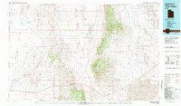
1981 · Tule Valley
USGS Topo · 1:100,000