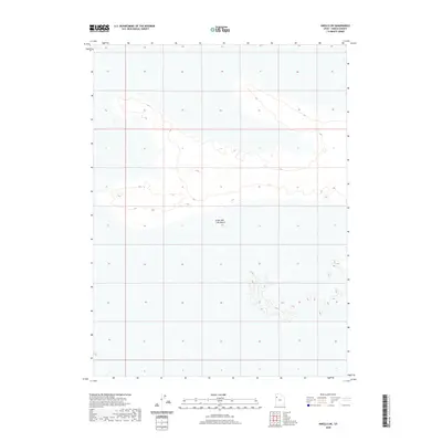
2020 Map of Knolls SW
USGS Topo · Published 2020About this map
The Great Salt Lake Desert dominates this landscape in western Tooele County, captured in a 2020 survey that reveals the stark and minimal topography of this arid region. The map illustrates a series of low-lying terrain elevations and seasonal basin characteristics typical of the eastern Great Basin. Unlike more developed quadrangles, this area remains defined by its natural geography rather than human infrastructure. The sparse contour lines and lack of named settlements emphasize the vast, open nature of the salt flats. This detailed rendering by the U.S. Geological Survey provides an essential record of the surface elevations and section lines across this distinctive Utah landscape, useful for understanding the geomorphology of the Great Salt Lake Basin.
Find a feature on this map
1 named feature on this map. Tap any name to fly to it.
Don’t see what you’re looking for? This feature index may not catch every label — zoom into the map to look around manually.
Map Details
Editions of this 2020 Knolls SW Map
This is the sole edition of this map. No revisions or reprints were ever made.
Other maps of this area

1953 · Tooele
USGS Topo · 1:250,000

1954 · Wildcat Mtn
USGS Topo · 1:24,000

1955 · Tooele
USGS Topo · 1:250,000

1973 · Knolls SW
USGS Topo · 1:24,000

1973 · Arinosa SE
USGS Topo · 1:24,000

1973 · Arinosa NE
USGS Topo · 1:24,000

1973 · Wildcat Mountain NW
USGS Topo · 1:24,000

1973 · Knolls
USGS Topo · 1:24,000

1973 · Barro
USGS Topo · 1:24,000

1973 · Knolls SE
USGS Topo · 1:24,000